
Auvergne - the four departments
Admistrative
Departments of Auvergne - the four counties
 Auvergne
guide Auvergne
guide |
 The
Departments / counties The
Departments / counties |
 Auvergne food and drink Auvergne food and drink |
 Things to see and do in
Auvergne Things to see and do in
Auvergne |
 The
Auvergne in figures The
Auvergne in figures |
 Auvergne holiday cottages Auvergne holiday cottages |
Admistrative Departments of Auvergne - The four counties
The
Auvergne (historic region) consists of
four departments or counties :
the Allier, the Puy de Dôme, the Haute Loire and the Cantal
four departments or counties :
the Allier, the Puy de Dôme, the Haute Loire and the Cantal
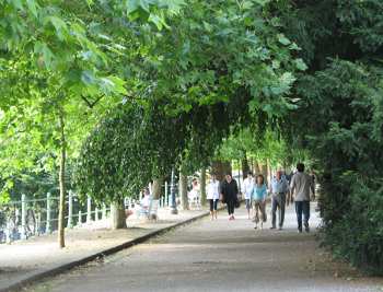
Leafy walk in the elegant spa town of Vichy, in the Allier
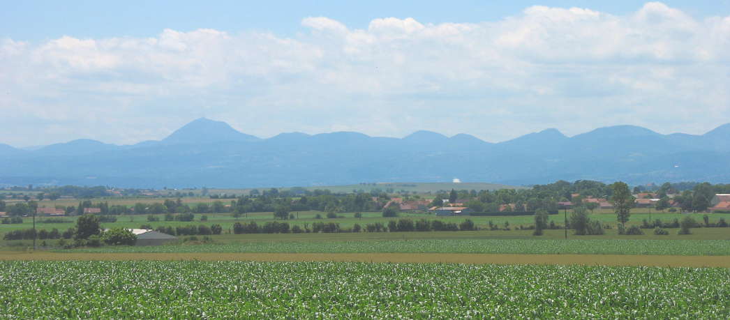
The "Puy de Dome" in the middle - largely mountainous, but with a large fertile agricultural plain, the Limagne, in the middle, to the east of Clermont Ferrand. With its tall old houses built of black volcanic stone, Clermont-Ferrand, a city of about a quarter of a million inhabitants, is the home of the Michelin tyre company, and a rather austere city; it lies at the juncture between the fertile agricultural plain called the Limagne, and the Massif Central mountains behind and is dominated by the 1500 metre Puy de Dôme, a massive dormant volcano. This is the most famous peak in the "chaine des Volcans", the largest dormant volcanic region in western Europe. South of Clermont lies the Massif du Sancy, a small alpine-looking cluster of mountains slightly higer than the Puy de Dome itself, and culminating in the Puy de Sancy, at 1885 metres, the highest point in the central part of France.
The western part of the Puy de Dome department is an upland area, well watered by the rain brought in on Atlantic airstreams. It is an area that traditionally remains green and mild in the summer. The waters that have fallen on these hills and mountains over the centuries emerge, well mineralised, at famous springs in towns such as Le Mont Dore, Volvic, or Saint Nectaire.. In the south of the department, bordering on the Cantal, lies an area known as the Cezallier, an area of high prairies not unlike parts of the American west, and a land grazed by large herds of cattle.
The eastern part of the department, east of the river Allier, is an area of high ground, the Monts du Forez, which, as their name suggests, are largely covered with spruce forests. The small city of Thiers, to the east of Clermont-Ferrand, is reputed as the knife-making capital of France. In the past, the cutlery industry was powered by the water of streams and rivers gushing down off the mountains.

The "Chaine des Puys" - looking from the Puy de Dome department towards the Allier. Photo Romary - Licence CC
The Haute Loire in the south east, the driest and sunniest part of the Auvergne, a lot of it at an altitude of over 800 metres. Virtually the whole department is hilly or mountainous, and a lot is forested. The northern area is centered round the market town of Brioude, with its magnificent romanesque basilica, the largest in the region. South of Brioude lies the "Haut Allier", a region with deep valleys, a generally warm and sunny climate and a definite flavour of the south of France.
The southern part of the department is known as "le Velay"; its capital, Le Puy en Velay, was a major pilgrimage centre in the middle ages, a starting point on the route to Santiago de Compostella, and to this day the city's cathedral and St Michael's chapel remain remarkable examples of early mediaeval architecture. Robert Louis Stevenson set off from Le Monastier, just south of Le Puy, in his famous travelogue "Travels with a donkey". In the south, the Haute Loire borders on the department of the Ardèche, and the top of the Cevennes mountains.
The Cantal, in the south west, is the highest of the four departments, a lot of it over 1000m altitude. The department boasts two main centres, the bustling market town of Aurillac, the department's capital, to the west of the high mountains, and Saint Flour, an ancient town perched dramatically at the top of a volcanic outcrop in the east of the department, and visible from the motorway. The centre of the Cantal is dominated by the Plomb du Cantal and the peaks around it, a massive volcanic cluster marking the heart of the Massif Central mountains. The Plomb du Cantal is very accessible, as it rises above the ski resort of Super Lioran, which is just beside the main trunk road between Clermont Ferrand and Aurillac. The department is famous for its cheeses, notably the eponymous "Cantal" cheese, and the delicious Auvergne Blue - bleu d'Auvergne - much of which is produced in the Cantal highlands. Another Cantal monument is a famous viaduct, the Viaduc de Garabit, designed by Gustave Eiffel. The viaduct spans the gorge of the Truyère river, and can be admired from a special visitor centre on the A75 motorway
© Gitelink.com

A Gitelink
guide
Accueil: l'Auvergne en français
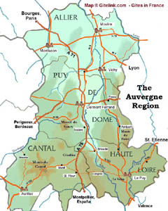
Click map to Enlarge
| Click map to Enlarge |
| Useful links |
| Gites in Auvergne |
| Auvergne tourist office |
| Airport - Clermont Ferrand |
| Official Puy de Dome tourism site in English |
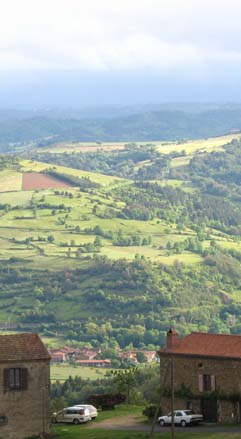
In the Haut Allier -Haute Loire
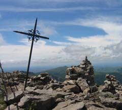
Summit of the Puy Mary - Cantal
All texts
& photos ©
Gitelink.com.
| More regional guides |
| Guide to Provence |
| Guide to Brittany |
| Guide to Languedoc-Roussillon |
| Other regions of France |