
A short guide to the regions of SpainThe autonomous regions of Spain; regional overviews, landscape, economy, climate, tourismA short guide to continental Spain |

| Gitelink France | Home page for full-screens | French route maps | French travel and tourism guide |

Traditional rural accommodation and gites in Andalucia
and the Canary islands
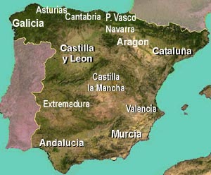
The regions, or autonomous communities, of Spain
| Galicia | Asturias & Cantabria | Aragon |
| Castile & Leon, Navarra | Castile la Mancha | Catalonia |
| Extremadura | Andalucia | Valencia / Murcia |
 For
much of its recent history, Spain has been a country of conflicting
identities; on the one hand a national identity hingeing on the concept
of Spain as a single country; on the other hand a network of regional
identities, many regions of Spain displaying distinct regional
characteristics, and even using their own distinct languages.
For
much of its recent history, Spain has been a country of conflicting
identities; on the one hand a national identity hingeing on the concept
of Spain as a single country; on the other hand a network of regional
identities, many regions of Spain displaying distinct regional
characteristics, and even using their own distinct languages.In the time of General Franco, the vision of Spain as a single united country prevailed, and was even enforced; in the modern post-Franco era, Spain has taken the path of devolution, with the creation of "autonomous communities" with their own parliaments, institutions, cultural identities and even languages. Though "Spanish", often reffered to as "Castilian", remains the main language spoken in modern Spain, it is by no means the only language. In Catalonia, the most prosperous region of Spain, the official language is Catalan; and in the Basque country, Basque exists alongside Spanish. But even in some provinces where Castilian Spanish is widely spoken, it exists alongside regional dialects or languages. This is the case in Valencia and Galicia
Galicia
Capital: Santiago de Compostella. Biggest city: Vigo
Galicia lies at the northwest tip of Spain. An Atlantic coastal region, it benefits from a temperate climate and adequate rainfall, making it the greenest region in Spain. The population of Galicia is concentrated along the coast, and in the cities of Vigo and A Coruña (Coruna), major port cities. Vigo is the largest fishing port in Europe, and an industrial hub, with shipbuilding and car manufacturing.
Away from the urban areas, Galicia has a dramtic rocky coastline, deeply indented on the western side by fijord-like inlets, rock but less indented along the northern coast.
Inland from the coast, Galicia remains a relatively poor agricultural region, with a lot of small farmers. The terrain is hilly and rocky, and in many parts densely forested.
Galicia and Asturias, like Brittany or Wales or Ireland, belong to Europe's Celtic fringe and share certain cultural traditions such as bagpipes.
Asturias & Cantabria
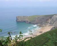
For most of its length, the coastline of northern Spain is hilly or even mountainous. Behind a narrow and fertile coastal plain, the terrain rises steeply into the mountains of Cantabria and Asturias, known collectively as the Cantabrian Mountains, culminating in the the Picos de Europa, dramatic and rocky mountains with deep valleys and soaring peaks. The area has been nicknamed "Switzerland on the sea", on account of the proximity of high mountain peaks, green valleys, and the Atlantic ocean.
Tourism was slow to develop here, and the north coast of Spain has not seen to much of the urbanization that has blighted long stretches of Spain's Mediterranean coast. Nevertheless, around the ports of Santander and Gijon, the coastline has seen a fair amount of tourist development in recent decades. Away from this, there are long stretches of relatively unblemished coastline, with fields and meadows coming right down to the water's edge - or in most cases, the clifftops.
Like Galicia, Cantabria and Asturias are parts of what is known as "Green Spain" (España Verde) on account of their oceanic climate. They are small regions, just including the coastal areas and the northern slopes of the Cantabrian mountains.
More on Asturias
Basque Country / Pais Vasco / Euskadi
Capital Vitoria (Gasteiz)
Though renowned through Spain and beyond on account of its violent separatist movement ETA, the Basque country is actually the most propserous region in Spain in terms of GDP per inhabitant, thanks to its industrial sector, its tourism and its agricultural activity. There are two official languages in the Basque Country, Basque (Euskara) and Spanish (Castilian): having totally different origins, the Basque language is completely different from Spanish, which explains why many places in the Basque area have two quite different sounding names.
The region has two big industrial and commercial cities, the ports of Bilbao and San Sebastian (Donostia). Between them, the rocky Atlantic coastline offers a number of small resorts that have seen development in recent decades, though not on the scale of the Mediterranean coast.
The northern half of the Basque country is hilly - the Basque hills being the westward extension of the Pyrenees. But unlike the Spanish Pyrenees, the Basque hill country benefits from more rainfall, making it a green and wooded area. The hills and valleys are dotted with small villages and isolated farmsteads, and are popular with ramblers and hikers. The southern part of the Basque Country, the province of Avala, south of the coastal mountains, enjoys a much more continental climate. Most of the population of Avala is concentrated in the Vitoria conglomeration. Beyond the capital city, the area is largely agricultural, particularly on the flat expanses of the upper Ebro valley.
Aragon
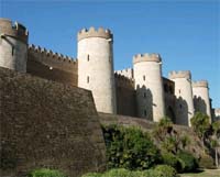
Zaragoza
Landlocked Aragon, where the people speak Spanish, is a sparsely-populated province which is mainly rural - with agriculture wherever it is possible. However, on its dry hilly areas, little economic activity is possible beyond grazing and in places, and where the land is accessible, forestry.
The northern parts of Aragon is made up of the Pyrenees mountains which, on this southern side, are fairly dry and arid. Narrow valleys with rocky gorges are characteristic of this region. South of the Pyrenees, the wide Ebro valley around Zaragoza or Saragossa is a fertile agricultural region. In the south east, between the fertile agricultural plains and the coast, lies a dry hilly area of Mediterranean pine forest and olive groves.
This part of Spain is, like most regions, rich in history and culture, particularly visible in the Moorish and Mozarab heritage of Zaragoza , the Mudejar heritage of Teruel, and ancient castles such as the Romanesque fortress at Loarre.
Castilla y Leon / Castile and Leon:
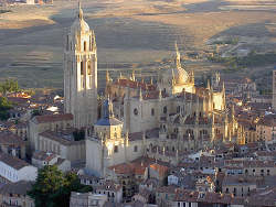
Segovia, Castilla y Leon
Photo McPolu,
This is the heart of Spain. The historic region of Castile was the area round the capital Madrid, and the historic heart of Spain. Old Castile is now split into three regions, with Castile & Leon the largest of the three in terms of surface area, though not in terms of population. Madrid itself, historically the capital of Castile, is now an independent autonomous metropolitan region
In the past, Castile was a wild desolate area, where people lived together in fortified cities or castles; many of these survive to this day, including some of the jewels in the Spainsh crown, the cities of Avila, Salamanca or Segovia, all classed as UNESCO world heritage sites - not forgetting the great cultural heritage of other cities such as Leon, Valladolid or Burgos, or the amazing romanesque cloisters of the monastery at Santo Domingo de Silos.
The great open expanses of Castile are largely given over to agriculture, particularly cereals; but most of this region lies at an altitude of 800m or more, and the climate is dry and cold in winter, dry and hot in summer. Though the mountains in around the Castilian mesa support pine forests, there are large expanses in the middle of the region where it is only alongside water courses that trees grow naturally, and irrigated farming can be practised.
More on Castile y Leon
Madrid
Historically part of Castile, Madrid today is its own autonomous region, and the most densely populated area in Spain. The Spanish metropolitan area is home to about 6 million people, and is a bustling and prosperous area, with a strong serviced-based economy. The area has seen massive development in the past decades.
Old Madrid is famous for its urban architecture, its ornate churches and its world-famous museum and art-gallery the Prado. Like the rest of central Spain, Madrid enjoys a continental climate, hot and dry in summer, cold and largely dry in winter. The city lies at an altitude of almost 650 metres above sea level, making it the highest capital city among European union member states.
Catalonia
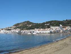
Northern Costa Brava
Catalonia is the richest and, with almost seven million inhabitants, the second most heavily populated region of Spain.
The first thing that surprises many visitors when they first visit Catalonia is that people in this region don't speak Spanish. Freed from the constraints of the Franco era, when Castilian Spanish was imposed throughout Spain, Castilian autonomous governments have reinstated Catalan as the regional language, to the point where it is now usually the only language used. For example, in museums, items are sometimes labeled in Catalan and English, but not in Castilian Spanish - to the annoyance of visitors from other parts of Spain. That being said, Catalan and Castilian are sufficiently close for most Spanish-speakers to be able to understand road-signs and other information.
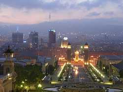
Evening in Barcelona
Photo Baikonur
Catalonia, bordering on France, is the most easily accessible of Spain's regions, and the Costa Brava was the first part of Spain to rush headlong into mass tourism development. North and south of Barcelona, the coast is a string of suburban and holiday developments, crowding in on the small seaside towns. Today there are nevertheless still a few unspoilt places along the coastline, particularly in the north of the region; but it is the region's hinterland that offers the wide spaces and the natural areas that attract visitors in search of an escape from the crowds. The Catalonian Pyrenees, popular with hikers and outdoor enthuiasts, offer some magnificent rocky mountain scenery, dramatic gorges, peaks and magnificent vistas, but also a rich collection of historic sites, such as the UNESCO World Heritage listed mediaeval churches in the area of Tahull.
Navarra & Rioja
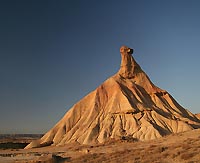
Bardenas Reales, Navarra
Navarra is a region covering the foothills and central western section of the Pyrenees, bordering on France and the Basque country. But like Castile it is a region that is very dry in parts, even barren and inhospitable, and the Bardenas Reales natural park offers some spectacular semi-desert landscapes reminiscent of America's Wild West .
Navarra is the leading region of Europe in terms of renewable energy, with a target of 100% renewable energy use by 2050. Almost half the region's electricity is produced by the area's 28 wind farms, with hydroelectricity being the second source. With its dry sunny climate, Navarra also has potential for the development of solar power.
To the south of Aragon , Rioja, along the upper Ebro valley, is the smallest region in Spain, and notably famous for its wines.
Castilla la Mancha
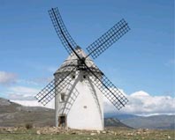
Windmill in Castilla la Mancha
Castilla la Mancha is another sparsely populated region, but one where agriculture is more extensive. Between the cities of Albacete and Ciudad Real vast wheat fields stretch as far as the eye can see, and there are also important vineyards and other crops. Where there are hills, they are dry and barren, but windy too; this is the country where the legendary Don Quixote wanted to fight the windmills.
The cultural heritage of Castila la Mancha has remained remarkably intact, notably with the dramatic city of Toledo, the former home of the great Spanish painter El Greco. The area around Todedo is famous for its olives.
Plans by an American company to build a massive Las Vegas style casino close to Ciudad Real have been shelved, much to the relief of many local inhabitants.
More information on Castile la Mancha region
Extremadura.
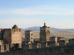
Trujillo
Extremadura, bordering to its west on Portugal, is, and has long been, the poorest region in Spain; in the past, its poverty led to many of its population fleeing elswhere in search of better fortune, often to South America. Two of the greatest "Conquistadores", Pizarro and Cortés, were from this region, and they and others like them brought back from South America great wealth which they spent on large country estates and prestigious palaces in towns such as Caceres and Trujillo. Further south, the regional capital Merida was once an important Roman city, and boasts the finest Roman remains in Spain, including an amazing long Roman bridge and a large Roman theatre - as well as the Spanish national museum of Antiquity.
Today the region remains sparsely populated; large parts are too poor to cultivate, and are given over to subsitance farming. Elsewhere the landscape is of olive groves or scrub oak and in more fertile parts rolling fields of wheat. But the granite bedrock is never far below the surface, and indeed often breaks through in rocky tors.
The mountain areas of Extremadura are very wild, and popular with bird-watchers and hikers. Though for hikers, the infrastructure remains relatively limited. More information: Guide to Extremadura
Valencia & Murcia
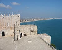
Peñiscola
The regions of Valencia and Murcia look steadfastly out to sea. In this dry central eastern part of Spain, it is on the coastal strip that the large majority of the population is concentrated; and it is a population that has vastly expanded in recent decades with the over-development of mile after mile of coastal resorts, "urbanizaciones" and their associated infrasructure. Yet the coastline is long, and there are still some relatively unspoiled sections of beach, or rocky coves, for those who want to get away from the crowds.
Apart from tourism, the main activity in this region is agriculture, particularly in the fertile valleys of Murcia, where large surfaces are given over to the production of fruit and vegetables. Valencia is the capital of the Spanish orange and citrus industry. The Moors introduced the cultivation of palm trees into this area, and the city of Elche, near Alicante, boasts Europe's only extensive palm groves.
Generally speaking this is a dry region, and the hills inland from the coast are arid and rocky, like much of Spain. Small villages and towns cling to hillsides, or stand beside rivers or streams; but this inland area is sparsely populated, and a world apart from the thronging crowds of Benidorm or La Manga.
Culturally, the region has plenty to offer, from the historic centres of Valencia and Murcia, to the palm groves of Elche and the moorish remains at Lorca and elsewhere.
More information on the Region of Valencia
Andalucia
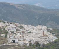
In the Alpujarras
Andalucia is the southernmost region of continental Europe; it is tha largest region in Spain, and has the largest population, most of it concentrated along the coast and in the Guadalquivir valley. While its once-beautiful coastline has been largely massacred by often uncontrolled property speculation and intensive agriculture (la "plasticultura"), inland, and often still quite close to the coast, Andalucia remains a magnificent region of hills and plains, with some of the richest cultural heritage in Spain.
Andalucia was the last European fief of the Moors, and "Al Andalus" boasts some of the finest historic vestiges of Moorish culture. The Moors were not driven out of Andalucia until 1492, the year in which Christopher Columbus first set foot in the Americas. The great Moorish heritage of Andalucia survives to this day in many Alcazars and other buildings, but most famously in the Mesquita at Cordoba and the Alhambra at Granada, among the most visited historic monuments in Europe.
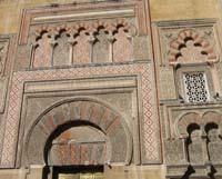
The mosque at Cordoba
Northern and eastern Andalucia is sparsely populated, many parts being characterised today by endless olive groves, largely a result of EU subsidies, not of any great historic tradition. Other parts, however, are dry and virtual semi-desert. Just inland from the port of Almeria lies the Desierto de Tabernas, the only area in Europe officially designated as a desert.
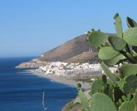
More information: Guide to Andalucia
Rural Accommodation in Spain
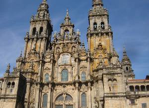
Cathedral at Santiago de Compostela, Galicia

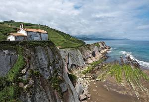
Coast of the Basque Country
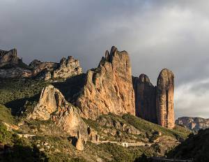
In the mountains of Aragon
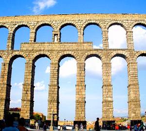
Roman aqueduct, Segovia
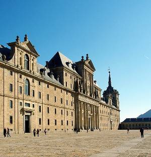
Monastery of El Escorial, just outside Madrid
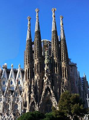
Gaudi's Sagrada Familia basilica - Barcelona.

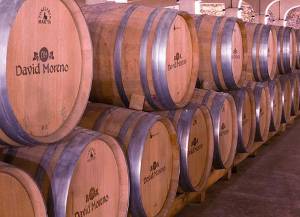
Wine cellars in the Rioja area
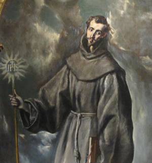
One of many works by El Greco in the churches and museums of Toledo
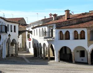
Garovillas - a small town in Extremadura
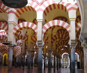
Cordoba, Andalucia. The 9th century Mosque - now part of the cathedral.
Copyright Gitelink.com 2007 - 2025
Photos.
All photos © About-Spain.net except where otherwise indicated.
Other photos reproduced under licence CC